 Ujaval Gandhi
Δημιουργία κώδικα στην Python για το πλαίσιο επεξεργασίας.
Προειδοποίηση
A new version of this tutorial is available at Writing Python Scripts for Processing Framework (QGIS3)
Μπορεί κανείς να γράψει αυτόνομο pygis κώδικα που να μπορεί να εκτελεστεί μέσω της κονσόλας Python στο QGIS. Με μερικά κόλπακια, μπορείτε να κάνετε τα αυτόνομα κομμάτια του κώδικά σας να εκτελούνται μέσα στο Πλαίσιο Επεξεργασίας. Αυτό έχει πολλαπλά πλεονεκτήματα. Πρώτον, παίρνοντας τα στοιχεία που εισάγει ο χρήστης και με βάση αυτά δημιουργώντας νεα αρχεία είναι σαφώς πιο εύκολο γιατί το Πλαίσιο Επεξεργασίας παρέχει μια τυποποιημένη διεπαφή χρήστη για αυτές τις λειτουργίες. Δεύτερον, το να έχετε τον κώδικά σας στην Εργαλειοθήκη Επεξεργασίας, επιτρέπει στον κώδικα να είναι μέρος από το Μοντέλο Επεκεργασίας ή να εκτελείται ως μια συνολική δουλειά με πολλαπλές εισαγωγές. Αυτή η άσκηση θα σας δείξει πως να γράψετε ένα προσαρμοσμένο κομμάτι κώδικα το οποίο θα μπορεί να είναι μέρος από το Πλαίσιο Επεξεργασίας στο QGIS.
Επισκόπηση της εργασίας
Our script will perform a dissolve operation based on a field chosen by the
user. It will also sum up values of another field for the dissolved features.
In the example, we will dissolve a World shapefile based on a SUBREGION
attribute and sum up POP_EST field to calculate total population in the
dissolved region.
Σημείωση
Αν θέλετε να κάνετε την διαδικασία κατακερματισμού υπολογίζοντας και κάποια στατιστικά στοιχεία, μπορείτε να χρησιμοποιήσετε το πρόσθετο DissolveWithStats. Αυτός ο κώδικας είναι μια παρουσίαση για το πως να εφαρμόσετε παρόμοιες συναρτήσεις μέσω ενός Κώδικα Επεξεργασίας.
Λήψη δεδομένων
Θα χρησιμοποιήσουμε το σύνολο δεδομένων Αdmin 0 - Χώρες από την σελίδα Natural Earth.
Κατεβάστε το Admin 0 - χώρες shapefile ..
Πηγή δεδομένων [naturalearth] _
Για ευκολία, μπορείτε να κατεβάσετε απευθείας ένα αντίγραφο και από το σύνολο των δεδομένων από τις παρακάτω συνδέσεις
Διαδικασία
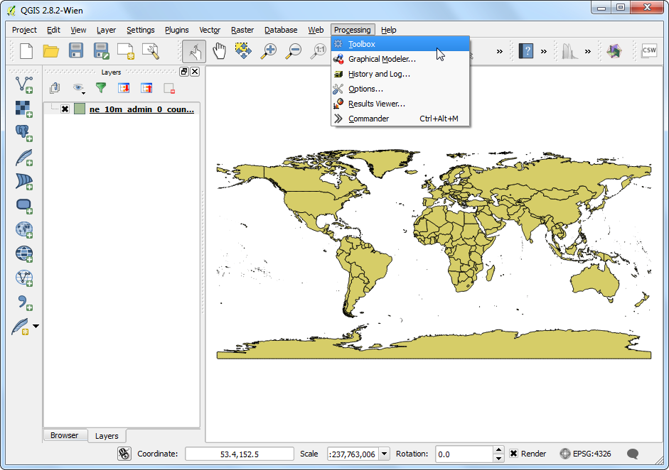
Ανοίξτε το QGIS και πηγαίνετε στο . Πηγαίνετε στο κατεβασμένο αρχείο
ne_10_admin_0_countries.zipκαι φορτώστε το στρώμαne_10_admin_0_countries. Πηγαίνετε στο .
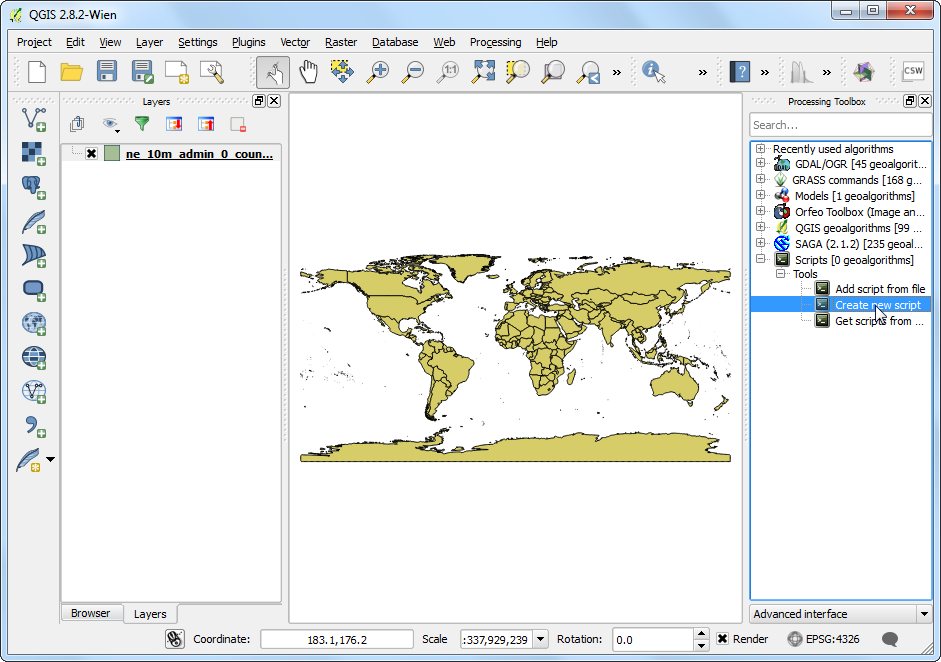
Επεκτείνετε την ομάδα Scripts`στο :guilabel:`Processing Toolbox και επιλέξτε Create a new script.
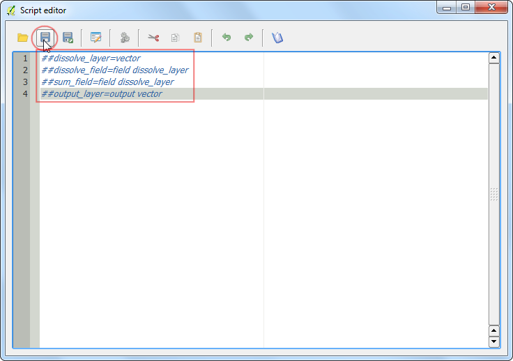
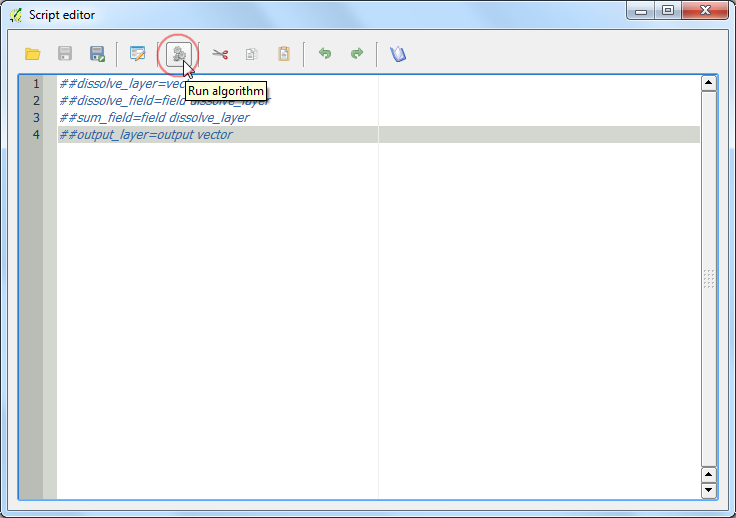
For a python script to be recognized as a Processing script, the beginning of the script must be the specifications of the input and outputs. This will be used to construct the user interface to run the script. You can learn more about the format of these lines from QGIS Processing Documentation. Enter the following lines in the Script editor. Here we are specifying 3 user inputs:
dissolve_layer,dissolve_fieldandsum_field. Note that we are addingdissolve_layerafter both the field input definitions. This means that input will be pre-populated with choice of fields from thedissolve_layer. We also specify theoutput_layeras the output vector layer. Click Save button.
##dissolve_layer=vector
##dissolve_field=field dissolve_layer
##sum_field=field dissolve_layer
##output_layer=output vector
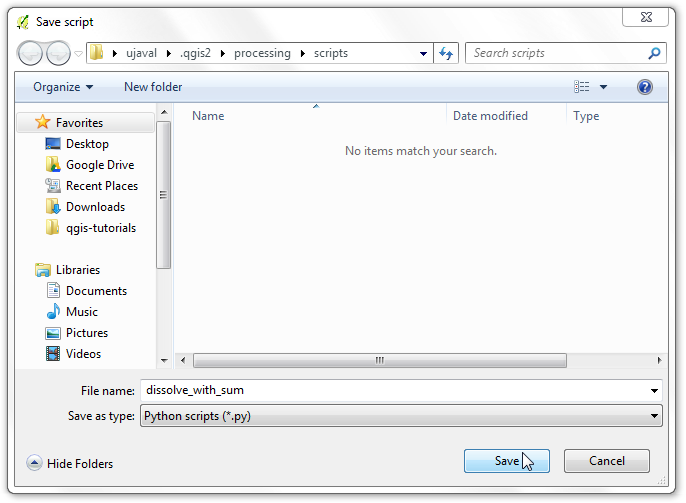
Name the script
dissolve_with_sumand save it at the default location under folder.
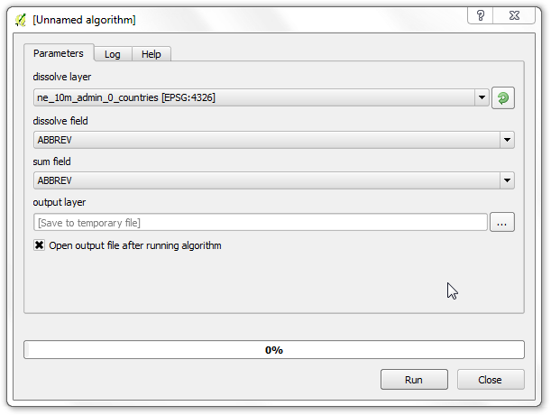
Back in the Script editor, click Run algorithm button to preview the user interface.
You can see that just by adding a few lines, we have a nice user interface for the user to specify the inputs. It is also consistent with all other Processing algorithms, so there is no learning curve involved in using your custom algorithm.
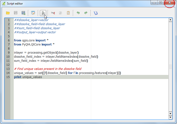
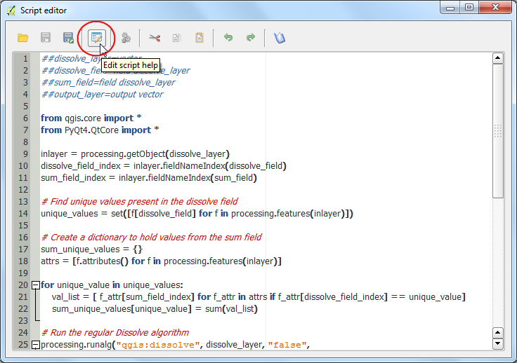
In the Script editor, enter the following code. You will notice that we are using some special methods such as
processing.getObject()andprocessing.features(). These are convenience wrappers that make it easy to work with data. You can learn more about these from Additional functions for handling data section of QGIS Processing Documentation. Click Save to save the newly entered code and then the X button to close the editor.
Σημείωση
This script uses python list comprehensions extensively. Take a look at this list comprehension tutorial to get familiar with the syntax.
from qgis.core import *
from PyQt4.QtCore import *
inlayer = processing.getObject(dissolve_layer)
dissolve_field_index = inlayer.fieldNameIndex(dissolve_field)
sum_field_index = inlayer.fieldNameIndex(sum_field)
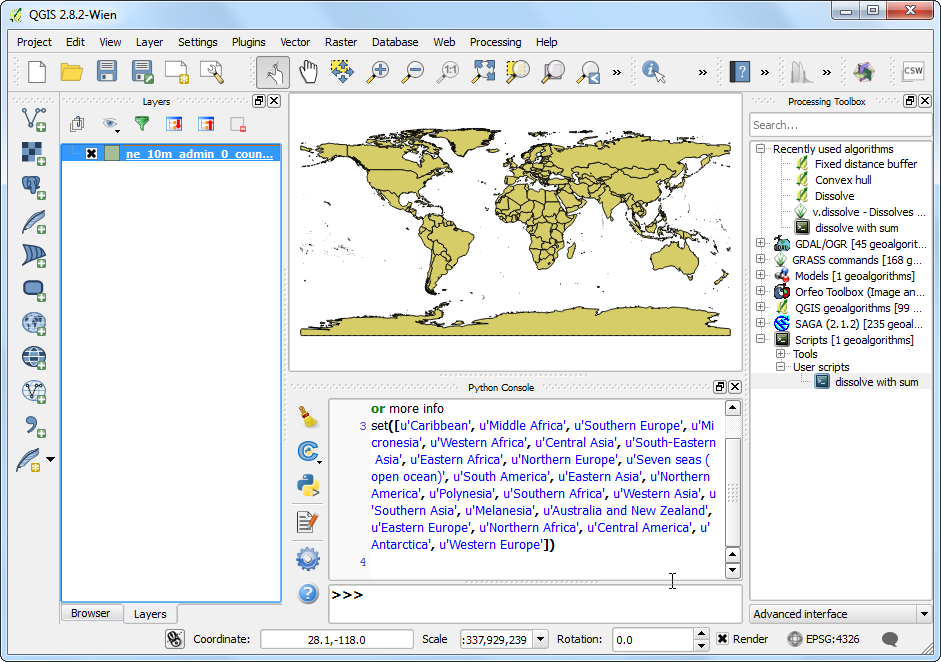
# Find unique values present in the dissolve field
unique_values = set([f[dissolve_field] for f in
processing.features(inlayer)])
print unique_values
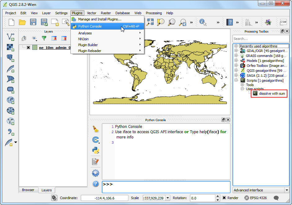
While writing code, it is important to be able to see errors and debug your code. Your processing scripts can be debugged easily via the built-in Python Console. In the main QGIS window, go to . Once the console is open, find your script in the Processing Toolbox and double-click it to launch it.
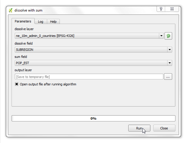
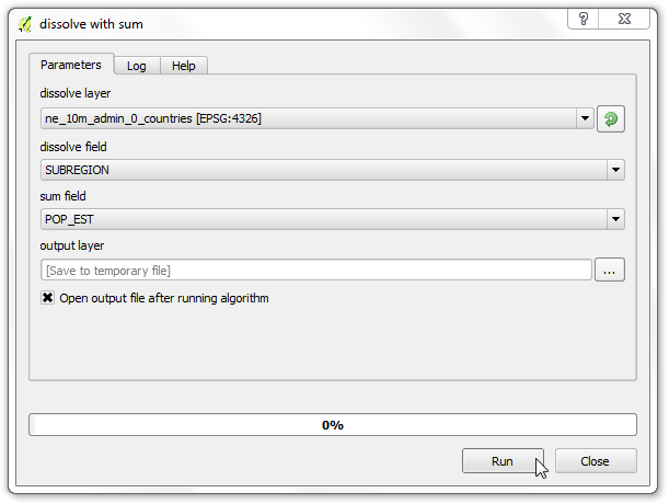
Select
SUBREGIONas the dissolve field. You may choose any field as the sum field as the script doesn’t have any code yet to deal with it. Click Run.
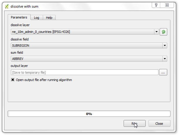
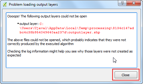
You will see an error dialog. This is expected since the script is incomplete and doesn’t generate any output yet.
In the main QGIS windows, you will see the debug output from the script printed in the console. This is useful way to add print statements and see intermediate variable values.
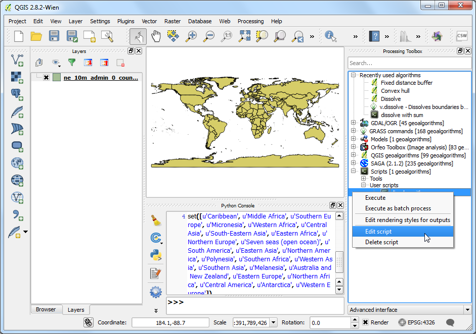
Let’s go back to editing the script by right-clicking the script and select Edit script.
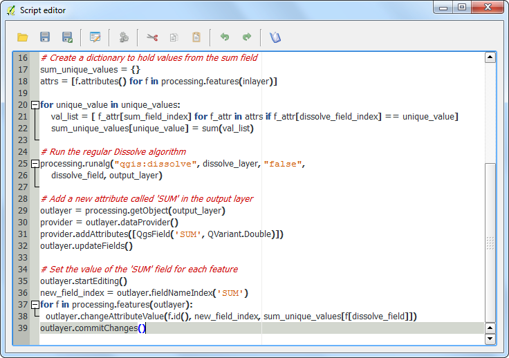
Enter the following code to complete the script. Note that we are using the existing dissolve algorithm in QGIS via processing using
processing.runalg()method.
# Create a dictionary to hold values from the sum field
sum_unique_values = {}
attrs = [f.attributes() for f in processing.features(inlayer)]

for unique_value in unique_values:
    val_list = [ f_attr[sum_field_index] for f_attr in attrs if f_attr[dissolve_field_index] == unique_value]
    sum_unique_values[unique_value] = sum(val_list)

# Run the regular Dissolve algorithm
processing.runalg("qgis:dissolve", dissolve_layer, "false",
    dissolve_field, output_layer)

# Add a new attribute called 'SUM' in the output layer
outlayer = processing.getObject(output_layer)
provider = outlayer.dataProvider()
provider.addAttributes([QgsField('SUM', QVariant.Double)])
outlayer.updateFields()

# Set the value of the 'SUM' field for each feature
outlayer.startEditing()
new_field_index = outlayer.fieldNameIndex('SUM')
for f in processing.features(outlayer):
  outlayer.changeAttributeValue(f.id(), new_field_index, sum_unique_values[f[dissolve_field]])
outlayer.commitChanges()
Run the algorithm by selecting
SUBREGIONas the dissolve field andPOP_ESTas the sum field. Click Run.
Σημείωση
The processing algorithm may take upto 10 minutes to finish depending on your system.
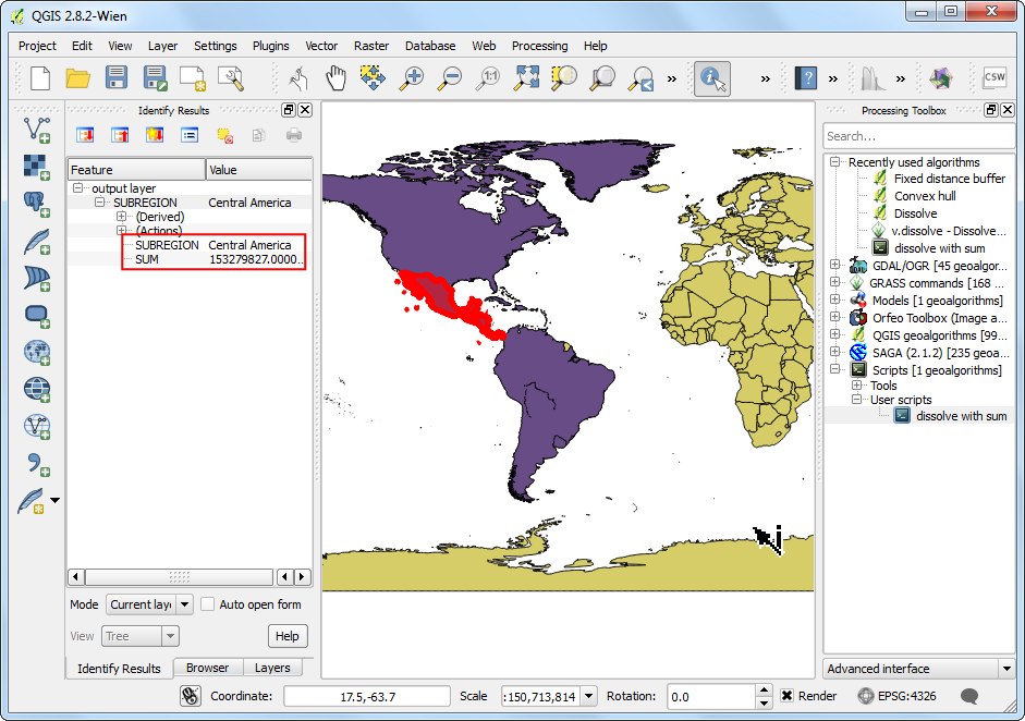
Once the processing finishes, you can use the Identify tool and click on any polygon. You will see the newly added
SUMfield with thePOP_ESTvalues from all original polygons added up.
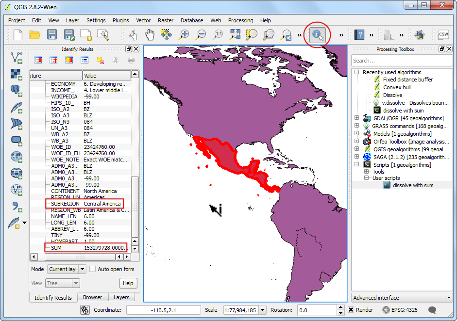
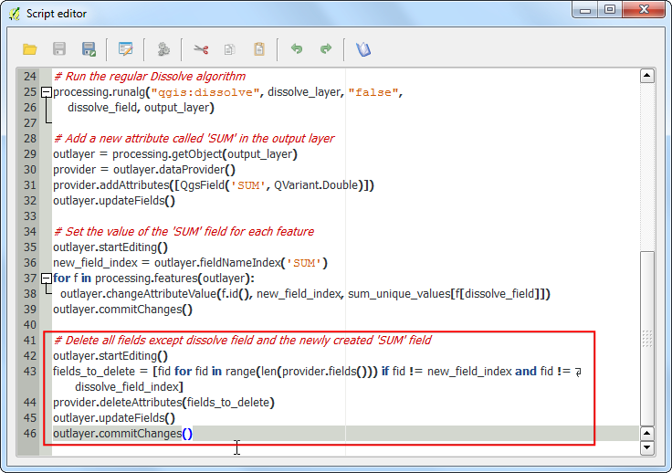
You will note that all other fields in the output are still present. When you dissolve many features to create a single feature, it doesn’t make sense to keep the original fields in the output. Go back to the Script editor and add the following code to delete all fields except the
SUMfield and the field that was used to dissolve the original layer. Click Save button and close the window.
# Delete all fields except dissolve field and the newly created 'SUM' field.
outlayer.startEditing()

fields_to_delete = [fid for fid in range(len(provider.fields())) if fid != new_field_index and fid != dissolve_field_index]
provider.deleteAttributes(fields_to_delete)
outlayer.updateFields()

outlayer.commitChanges()
One of the hidden features of the Processing Framework is that all algorithms can work on selected features of a layer. This is very helpful when you want to run an algorithm on the subset of a layer. As our script uses
processing.features()method to read features, it will respect the current selection. To demonstrate that, let’s make a selection first. Click on the Select features using an expression button.
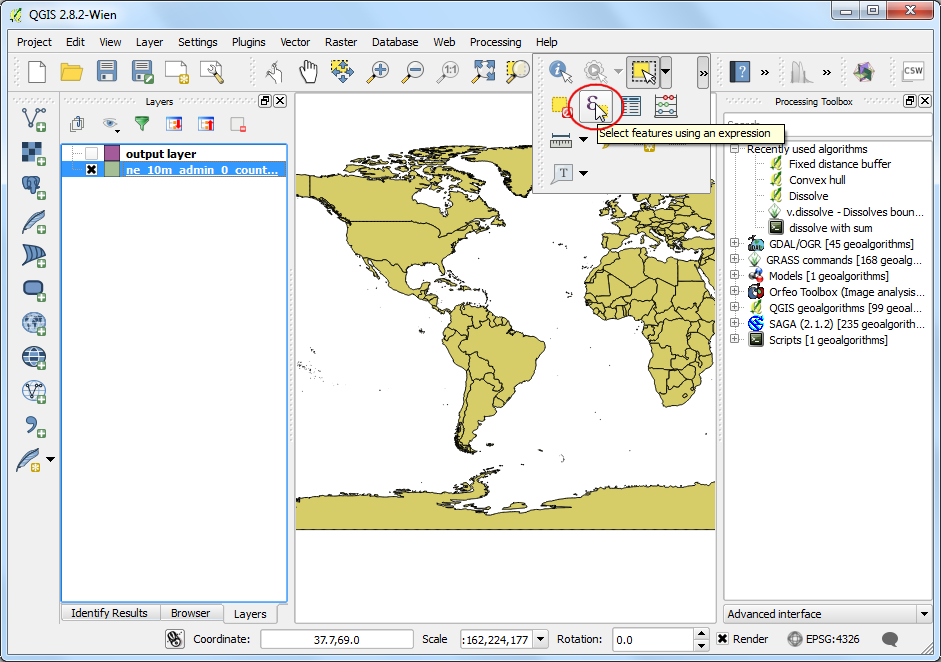
Enter the following expression to select features from North and South America and click Select.
"CONTINENT" = 'North America' OR "CONTINENT" = 'South America'
You will see the selected features highlighted in yellow. Right-click the
dissolve_with_sumscript and select Execute.
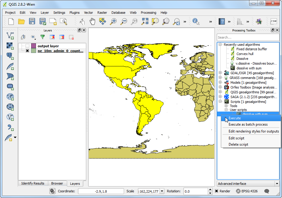
Select the inputs as before and click Run.
A new
output layerwill be added to QGIS. This will contain dissolved geometries only from the selected features in the input layer. You will also note that theoutput layerwill contain only 2 fields as expected.
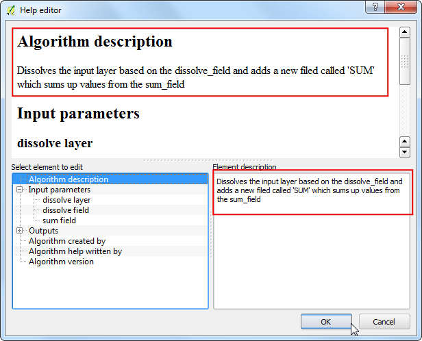
One last but important remmaining work is to document our algorithm. The Processing Framework has nice tools to write and access help. Go to the Script editor and click the Edit script help button.
Fill in the details for different elements and click OK. Now a detailed help will be available to all users of your script in the Help tab when they launch the algorithm.
Below is the complete script for reference. You may modify it to suit your needs.
##dissolve_layer=vector
##dissolve_field=field dissolve_layer
##sum_field=field dissolve_layer
##output_layer=output vector

from qgis.core import *
from PyQt4.QtCore import *

inlayer = processing.getObject(dissolve_layer)
dissolve_field_index = inlayer.fieldNameIndex(dissolve_field)
sum_field_index = inlayer.fieldNameIndex(sum_field)

# Find unique values present in the dissolve field
unique_values = set([f[dissolve_field] for f in processing.features(inlayer)])

# Create a dictionary to hold values from the sum field
sum_unique_values = {}
attrs = [f.attributes() for f in processing.features(inlayer)]

for unique_value in unique_values:
    val_list = [ f_attr[sum_field_index] for f_attr in attrs if f_attr[dissolve_field_index] == unique_value]
    sum_unique_values[unique_value] = sum(val_list)

# Run the regular Dissolve algorithm
processing.runalg("qgis:dissolve", dissolve_layer, "false",
    dissolve_field, output_layer)

# Add a new attribute called 'SUM' in the output layer
outlayer = processing.getObject(output_layer)
provider = outlayer.dataProvider()
provider.addAttributes([QgsField('SUM', QVariant.Double)])
outlayer.updateFields()

# Set the value of the 'SUM' field for each feature
outlayer.startEditing()
new_field_index = outlayer.fieldNameIndex('SUM')
for f in processing.features(outlayer):
  outlayer.changeAttributeValue(f.id(), new_field_index, sum_unique_values[f[dissolve_field]])
outlayer.commitChanges()

# Delete all fields except dissolve field and the newly created 'SUM' field
outlayer.startEditing()
fields_to_delete = [fid for fid in range(len(provider.fields())) if fid != new_field_index and fid != dissolve_field_index]
provider.deleteAttributes(fields_to_delete)
outlayer.updateFields()
outlayer.commitChanges()
If you want to give feedback or share your experience with this tutorial, please comment below. (requires GitHub account)